 |
Quarterly Newsletter
June 2025
Hi there, |
This quarter's MapGeo Community Spotlight – |

The Puritan Backroom in Manchester claims to be the birthplace of chicken tenders.
Manchester, NH isn’t just The Granite State's largest city — it’s also the birthplace of chicken tenders — “invented” in 1974 at the iconic Puritan Backroom on Hookset Road. The Puritan serves as just one of Manchester’s many beloved stops on the Presidential campaign trail. Just down the road, the Red Arrow Diner, also a true Manchester institution, has also welcomed candidates from Barack Obama to Donald Trump alike.
Talk to Manchester locals and they’ll point out their favorite local swimming hole of past and present, where local folklore says that if you dove too far, you just may have hit the mining equipment of an old, flooded granite quarry.
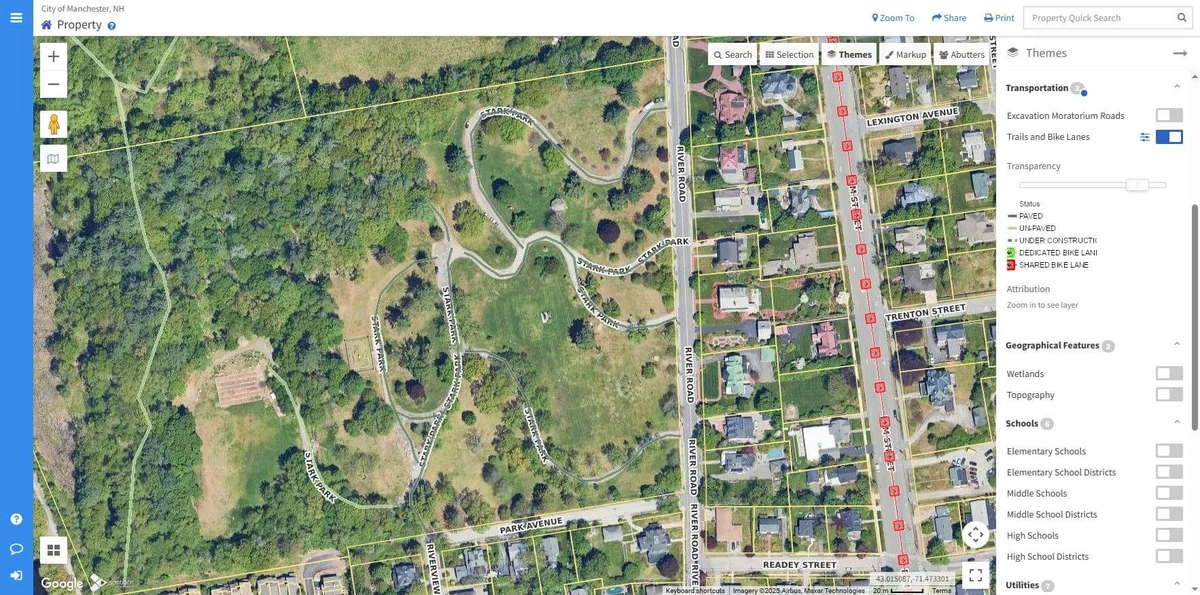
That same spirit of local pride and practicality fuels the city’s approach to modernizing services. Partnering with the AppGeo Division of Sanborn, Manchester uses MapGeo to support the Assessing Department and beyond — giving city staff centralized access to parcel data, water utilities, historic sites, and trail and bike networks. Locals can now easily access city parcel information, utility data, school districts, geographic features, and more.
“MapGeo enhances how the City serves both its staff and the community by streamlining property research, improving data accuracy, and accelerating key workflows. With tools like automatically putting buffers around properties to help create abutter lists, transparent zoning and aerial overlays, integrated street-level views, and easy access to assessing data, staff can make faster, more informed decisions. These capabilities reduce manual work, support effective planning and administration, and improve public service delivery— ensuring that City operations are efficient, responsive, and aligned with community needs.” - Amy Kizak, GIS Administrator, City of Manchester, NH |
MapGeo has become more than a map — it's a citywide tool for coordination, transparency, and making data-driven decisions that move Manchester forward.
Updating MapGeo State Themes |
The MapGeo team is revamping many of the state themes available on your MapGeo site. Please reach out if you have suggestions for new themes that use state-wide data from your state’s GIS organization! For example, Connecticut’s open space data, for many sites, this data was downloaded and published as a theme onto MapGeo when the site was first implemented. Since then, the state has created a GIS server where the open space data and many other data now live, that MapGeo can pull in directly into a theme. So, when updates to the data by the state, you will see them on MapGeo without needing to redownload and publish the data. |
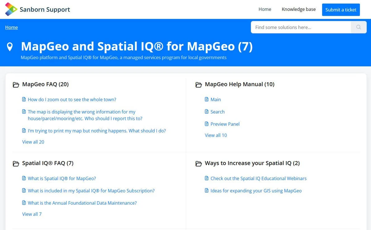
Updated Support Portal link |
We updated our Support Portal to make it easier to find answers to common questions, as well as finding ways to “increase your Spatial IQ.” Links to past webinars can be found here, along with links to all previous MapGeo newsletters, and MapGeo Help articles. We are always adding more questions to our FAQs, and adding more ideas that other customers have requested and implemented onto their site as part of their subscriptions. |
Upcoming Spatial IQ Webinar – Unlocking Insights from Imagery and Lidar Data |

Are you looking to capture new, or get the most out of your existing Imagery or Lidar data? Join us Tuesday, June 17th @ 1:00 PM EDT for an exclusive webinar on how Imagery and Lidar Data Extraction is used to create datasets for additional insight into the world around us.
Imagery and Lidar technologies are revolutionizing how we observe, analyze, and manage our man-made and natural environments. By extracting derivative datasets such as tree canopy, impervious surfaces, land cover, and urban infrastructure, these technologies enable insightful decisions for planning, compliance, and sustainability. From mapping heat islands to supporting stormwater management, our presenters will discuss how feature extraction from Imagery and Lidar enables smarter, faster, and more informed decision-making across municipal, county, and state-level projects.
|
Historic Property Record Cards and Assessment History on MapGeo |
The City of Newton, Massachusetts displays multiple years of total assessed values on their MapGeo site, giving residents and city staff a historical perspective on property values. Other communities host multiple years of property record cards, which provides a more complete picture of the changes in property values by allowing residents to track land, building, and improvement changes along with property images. Both options add richness to your MapGeo site, helping your users find the answers they need. |

The City of Newton’ s MapGeo site showing several years of assessment history.
West Hartford’s configuration of FEMA LOMA/LOMR data on MapGeo |
The Town of West Hartford, Connecticut keeps a record of changes to the National Flood Insurance Program through FEMA via Letters of Map Amendment (LOMA) and Letters of Map Revisions (LOMR). These letters are essentially an amendment to the map, stating that a particular property, although mapped within the Special Flood Hazard Area, is actually located on high ground and not subject to flooding. By using MapGeo, these map amendments and revisions are spatially located and linked to the authoritative letter of change. |

West Hartford’s FEMA LOMA locations with a pop-up configured to provide details and link to the LOMA document.
The End of The Fiscal Year is Here! |
If you have any remaining budget that needs to be used by June 30th, consider implementing a MapGeo add-on such as these new themes, new data views, Pictometry widget, dashboard access, or the CAMA Uploader. Contact MapGeo support (mapgeosupport@mapgeo.io) for more information. If you also have a Spatial IQ for MapGeo subscription with “special projects” support, remember to talk to your Project Manager soon about how to get the most value from that investment before the end of the fiscal year. |
Sincerely,
|
 |
 |
The Sanborn Map Company, Inc., 305 S. Rockrimmon Blvd, Suite 200, Colorado Springs, Colorado 80919 |